An interactive visit to the rocks
Do you know where the hiking trail goes through the park? Or what you won’t want to miss out on at the City of Rocks? You’ll find all this out and more, thanks to the easy-to-use interactive map.
- The hiking trail through the rock city is 3.5 km long and is marked with a green sign. You should allocate about 2.5 hours to complete it.
- The route around the sand quarry (blue trail) is 1.5 km long.
- The yellow trail (Vlčí rokle) leading to the Teplice rocks is 3,5 km long.
- The circuit around the Teplice rocks is marked with a blue sign and is 6 km long.
- We would like to inform visitors that there are no toilets available along the entire tourist route. At the entrance to the rocks, there is an information center with restrooms that you can use before embarking on your journey through the rocks.

1. Pitcher
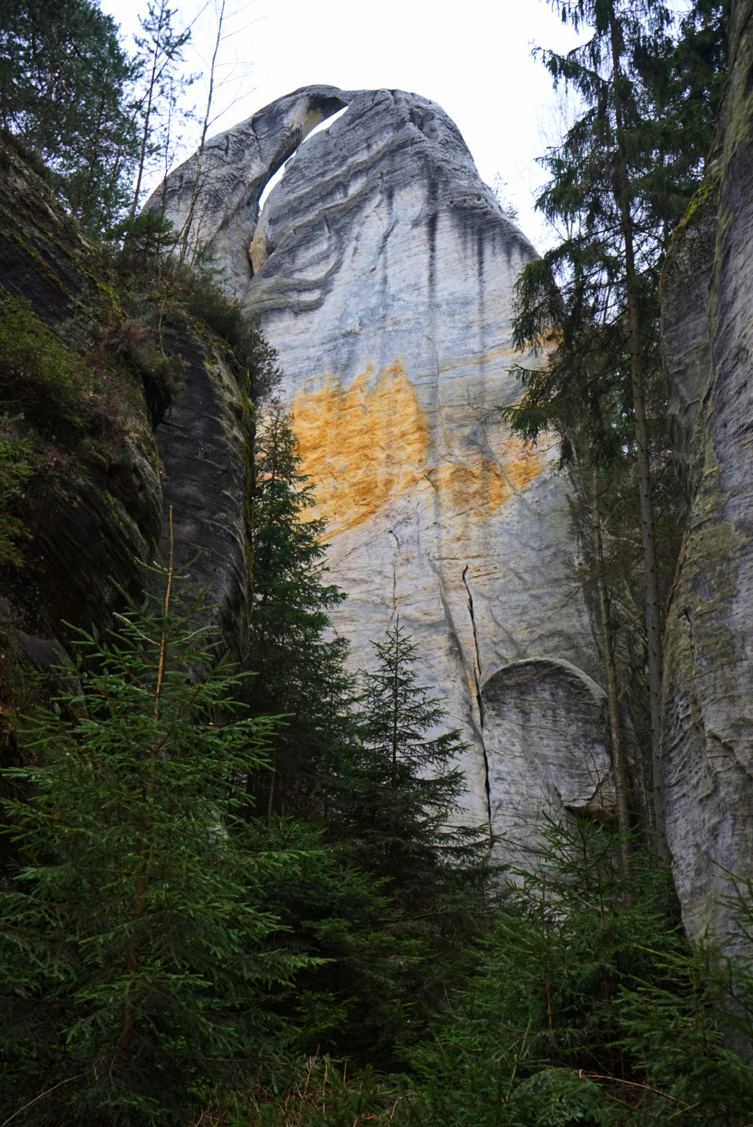
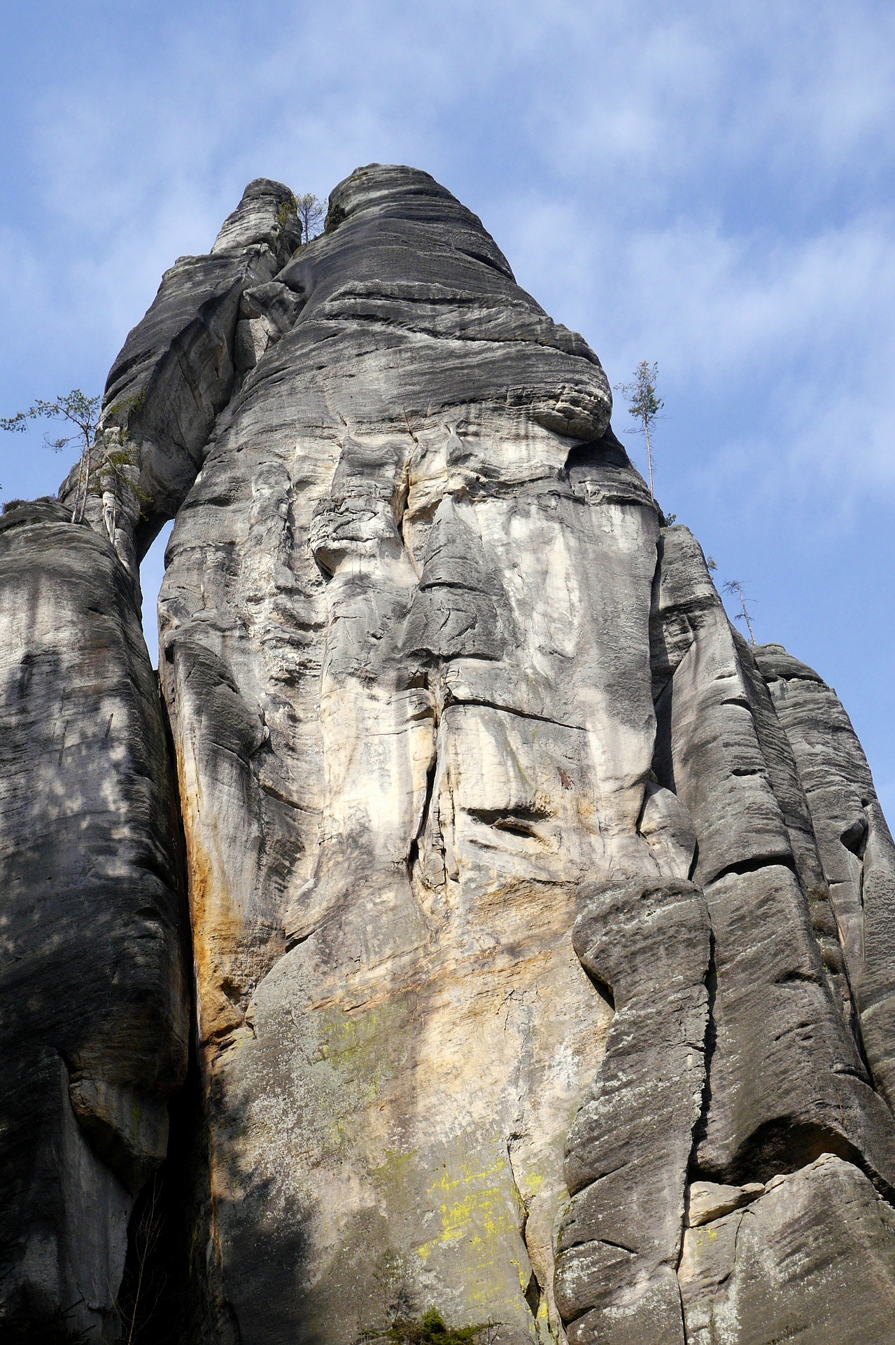
One of the most beautiful formations in the rock city is undoubtedly the Pitcher. Josef Janeba, Miroslav Jedlička, and climbing pioneer Rudolf Otto Bauš made the first ascent of this massive tower in May 1935. The first ascent followed a crack in the left part of the wall façade, leading to a large window and the summit. The unique six-meter window forms the "handle" of the pitcher, from which the tower got its name. It is often said that the handle resembles a dolphin. You will return through this way after completing the entire circuit of the rock city. Continue straight towards Homole cukru.
2. Sugar Loaf
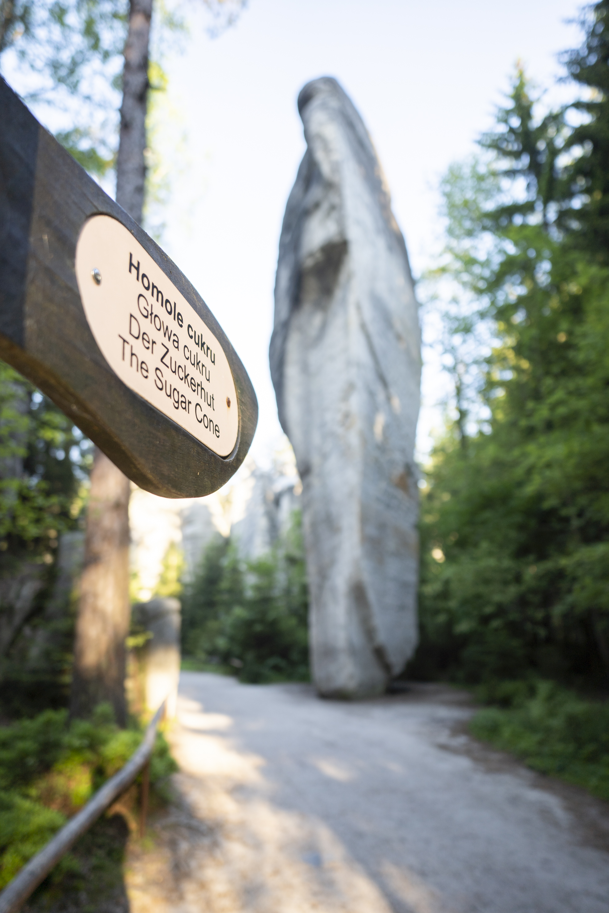
One of the most peculiar formations in the rock city is called Homole cukru, which translates to Sugar Loaf. What makes it unique is that it stands on its tip. The upper part is 13 meters wide, while the lower part is only 3 meters wide, resembling an inverted cone. Due to concerns about the rock's stability, tourists often place small sticks or branches at its base. At Homole cukru, you will cross a bridge over the Metuje River, which flows through the entire rock city.
3. Confluence of the Metuje River and Řeřichový potok
The Metuje River serves as the backbone and main watercourse of the Adršpach region. It flows through the Adršpach Rock City for a distance of less than a kilometer. It originates on the inner slope of Hodkovická kuesta, west of the Adršpach Rocks, at an elevation of approximately 625 meters above sea level. Originally, the Metuje River flowed through the Vlčí rokle (Wolf Gorge) to the east. However, its waters now cascade over an artificial dam at the Adršpach Lake, forming a several-meter-high waterfall, and continue northwards through the Adršpach Rock City. Řeřichový potok, a significant tributary, joins the Metuje River from the left, flowing from the Řeřichová rokle (Řeřicha Gorge). It drains the rugged rocky terrain of the western part of the Adršpach Rocks. These watercourses harbor communities of floating and submerged plants. Particularly noteworthy is the common water-starwort (Callitriche stagnalis), our largest species of moss, whose dark green thalli can reach lengths of several decimeters.
4. Gothic Gate
It appeared in the rock city as early as 1839 when it was built by Ludvík Karel Nádherný, along with a network of hiking trails, bridges, walkways, and staircases. The gate is located at the original entrance to the rocks.

5. Elephant Square
A space enclosed by rocks resembling elephants. Here you can admire the flora of the colder parts of the rock city, in a place with a typical microclimate of inverted gorges. Species that typically grow at elevations at least two hundred meters higher can be found here. These include bogbean, alpine pasqueflower, hawkweed ox-tongue, leafless gentian, and alpine milkvetch.

6. Krakonoš's Tooth
On this tall, elegant tower, there is a German inscription carved and a memorial plaque indicating the water level during a devastating cloudburst on June 23, 1844. The first ascent of the Tooth was undertaken on August 8, 1964, by Karel Hauschke and Jaroslav Krecbach.
7. Devil's Bridge
From Krakonoš's Tooth, following the tour route, we can see the tall Devil's Bridge to the right. Its arch reaches a height of 21 meters.
8. Elisabeth Tower
In the direction of our journey, the Elisabeth Tower stands tall. The rock got its name from the tower of the St. Elizabeth's Church in Wrocław. The first climbers to successfully ascend the Elisabeth Tower were Vladimír Škaroupka, Miloslav Jirka, and Miroslav Tomek, all from Náchod. Their ascent in 1947 marked one of the first Czech climbing achievements in the Adršpach Rocks. After crossing the wooden bridge, we will now pass through the Landshut Gate. To the left of its exit, there is a carved rock niche where a donation box for the maintenance of the rock city used to be placed.
9. Thunder Stone
In the rock city, there is a fallen stone with an incredible story attached to it. In 1772, two Englishmen visited the Adršpach Rocks with the intention of observing a thunderstorm in the cliffs. They waited for the natural catastrophe for eight days, and when it finally arrived, it was so intense that the Englishmen sought shelter as quickly as possible. They took cover under an overhanging rock, and in that instant, lightning struck in close proximity to them. A massive rock block detached from the opposite cliffs and collapsed in front of the startled Englishmen. Miraculously, both of them remained unharmed. To the right of the Thunder Stone, there is a right turn leading to the so-called New Part, and to the left, we will pass by the impressive Lion's Head and reach the Little Waterfall.

10. Small Square
In his travelogue from 1841, the Englishman Carl Herlossohn describes this place as follows: "A small meadow, surrounded by rocks and shrubs, refreshed by a silvery stream. In a semicircle, there are tables for resting, harpists playing, and weary pilgrims joking and refreshing themselves at the nearby gingerbread stand. A silver spring gushes from a dark rocky crevice, richly adorned with forget-me-nots and other charming flowers. One woman fills a glass with icy, crystal-clear water." At the end of the Small Square, the Small Waterfall cascades into a rocky gorge, and to the right of it, the Silver Spring emerges, although, admittedly, it is barely noticeable today. From the Silver Spring, the hiking trail continues to the right, leading up the stairs.
11. Stairs
Above the foot of the stairs, two inscriptions are carved, documenting that the access to the Great Waterfall was established for the convenience of visitors in 1820.
12. Busta Johanna Wolfganga Goetha
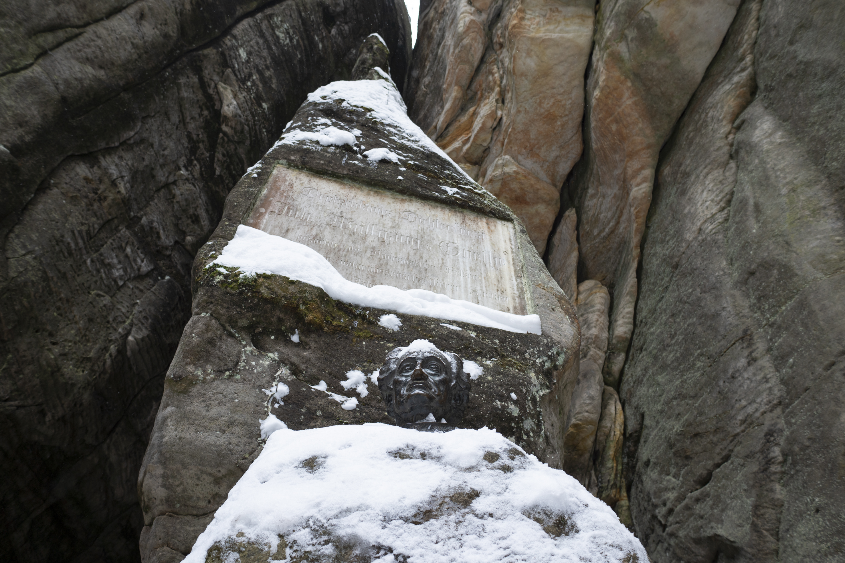
In honor of the visit of Johann Wolfgang Goethe, the administration of the Adršpach Rocks had a bronze bust cast, which was ceremoniously unveiled on July 10, 1932. You can find it at the entrance to the Great Waterfall. The author of the bust is the sculptor Emil Schwanter from Trutnov.
13. The Great Waterfall
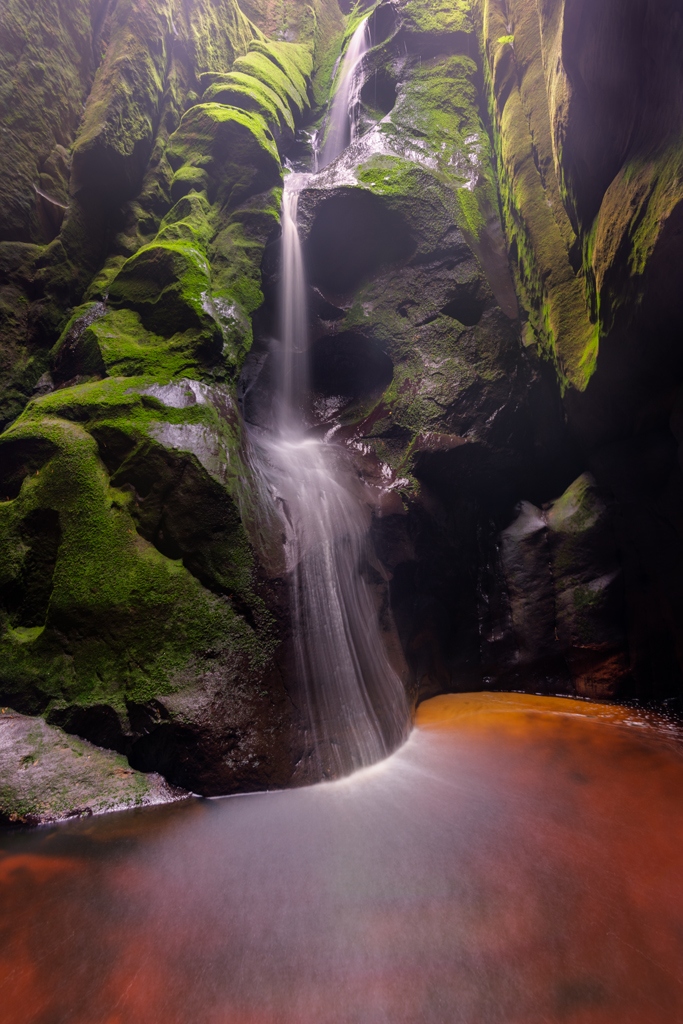
You will be captivated by the magnificent view of the Great Waterfall, which plunges into the rocky gorge from a height of 16 meters. The flow of the waterfall is regulated due to the presence of a small lake just above it, where boat trips are conducted. In winter, the Great Waterfall transforms into an equally enchanting icefall.
14. Rocky Lake, Boat Cruises
At the turn of the 18th century, Count Blümegen had a floodgate built here. The lake became a tourist attraction in 1857 when the first boat cruises were conducted. This is evidenced by an inscription carved into the rock at the boat dock. From the lake, you will return the same way back to the intersection before the Thunderstone, where the route continues along the circuit called the New Part to the viewpoint overlooking the Lovers (Milenci).

15. The New Part
The New Part was opened to tourists in 1890.
16. Lovers
One of the most famous formations in the Adršpach Rocks is also the highest one. It was first climbed by German climbers. Otto Rülke, Otto Dietrich, and Wilhelm Fiehl made the first ascent of the highest rock in Adršpach on June 18, 1923. From the Milenci viewpoint, you can descend the stairs to the crossroad below Uhlířská. Along the path to the left, after about sixty meters, you can reach the rock chapel located beneath the northwestern walls of the Lovers (Milenci).
17. Rock Chapel with Memorial Plaque
In the rock cave to the left above the Řeřichový stream, a rock chapel commemorates the tragic death of Josef Emanuel Nádherný during his ascent to the Lovers (Milenci) in 1929. The Nádherný family owned the Adršpach estate from 1828 to 1945. Thanks to extensive modifications and the establishment of new hiking trails during their rule, the rock city became a popular tourist destination. Other names on the metal plaques belong to climbers who dedicated their lives to the local rocks. From the crossroad below Uhlířská, you continue in the direction of the large circuit, ascending the stairs to the viewpoint called Velké Panorama.
18. Viewpoint and Great Panorama
To the left, we have the smooth peaks of Gilotin, and in the distance, we see the Lovers (Milenci) from a different perspective. On the right, we can observe the beginning of the Řeřichová Gorge. Řeřichová Cave, located at the bottom of the gorge, is the longest boulder cave in the Adršpach Rocks, stretching for 205 meters. It is home to several interesting animal species that sought shelter in the Adršpach caves during the warming at the end of the Ice Age and continue to survive to this day. These include harvestmen, whip scorpions, spiders, and other arthropods. The cave is also inhabited by a variety of bat species. From the Great Panorama viewpoint, you walk forty meters back and pass under the slender tower known as Cukrovarský komín to reach the viewpoint of the Mayor and Mayoress (Starosta a Starostová).
19. Viewpoint of the Mayor and Mayoress (Starosta a Starostová)
Here, we are presented with one of the most magnificent views: to the right, we have the Mayoress (Starostová), in the middle, the Mayor (Starosta), and to the left, the massive Štěpánská Crown. All three towers were conquered as early as the 1920s. From the viewpoint, you descend down steep stairs and then ascend again between the Mayor and Mayoress. You pass through a narrow gorge called Myší díra (Mouse Hole) and continue on a comfortable path towards the Echo (Ozvěna).
20. Echo
Since 1783, forest horns have been played and mortars have been fired here for the enjoyment of tourists. The sound of the shot echoes seven times from the rampart of Křížový vrch. From the Echo, the path leads you to the right until you reach the intersection at Homole cukru (Sugar Mound), where the large circuit through the Adršpach Rocks concludes. You will return the same way back to the entrance ticket office.
21. Sand quarry
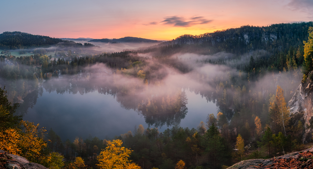
For those seeking romance, the crystal-clear sand quarry is a must-visit. The lake, with its pristine and transparent water, was formed by flooding an old sandstone quarry. Along the shores of the lake, there is a picturesque trail that stretches for 1.5 kilometers and offers resting spots along the way.
I.. Entry into the rock city
Entry into the rock city
II.. Entrance to the lake
Entrance to the lake
121. Body záchrany – rescue point
Bod záchrany je místo označené tabulkou s unikátním kódem pro snadné a jednoznačné určení vaší polohy v terénu při tísňovém volání. Tabulka kromě jedinečného identifikátoru (např. A 96, ZL 012) obsahuje tísňová telefonní čísla.
122. Body záchrany – rescue point
Bod záchrany je místo označené tabulkou s unikátním kódem pro snadné a jednoznačné určení vaší polohy v terénu při tísňovém volání. Tabulka kromě jedinečného identifikátoru (např. A 96, ZL 012) obsahuje tísňová telefonní čísla.
123. Body záchrany – rescue point
Bod záchrany je místo označené tabulkou s unikátním kódem pro snadné a jednoznačné určení vaší polohy v terénu při tísňovém volání. Tabulka kromě jedinečného identifikátoru (např. A 96, ZL 012) obsahuje tísňová telefonní čísla.
124. Body záchrany – rescue point
Bod záchrany je místo označené tabulkou s unikátním kódem pro snadné a jednoznačné určení vaší polohy v terénu při tísňovém volání. Tabulka kromě jedinečného identifikátoru (např. A 96, ZL 012) obsahuje tísňová telefonní čísla.
125. Body záchrany – rescue point
Bod záchrany je místo označené tabulkou s unikátním kódem pro snadné a jednoznačné určení vaší polohy v terénu při tísňovém volání. Tabulka kromě jedinečného identifikátoru (např. A 96, ZL 012) obsahuje tísňová telefonní čísla.
126. Body záchrany – rescue point
Bod záchrany je místo označené tabulkou s unikátním kódem pro snadné a jednoznačné určení vaší polohy v terénu při tísňovém volání. Tabulka kromě jedinečného identifikátoru (např. A 96, ZL 012) obsahuje tísňová telefonní čísla.
127. Body záchrany – rescue point
Bod záchrany je místo označené tabulkou s unikátním kódem pro snadné a jednoznačné určení vaší polohy v terénu při tísňovém volání. Tabulka kromě jedinečného identifikátoru (např. A 96, ZL 012) obsahuje tísňová telefonní čísla.
128. Body záchrany – rescue point
Bod záchrany je místo označené tabulkou s unikátním kódem pro snadné a jednoznačné určení vaší polohy v terénu při tísňovém volání. Tabulka kromě jedinečného identifikátoru (např. A 96, ZL 012) obsahuje tísňová telefonní čísla.
129. Body záchrany – rescue point
Bod záchrany je místo označené tabulkou s unikátním kódem pro snadné a jednoznačné určení vaší polohy v terénu při tísňovém volání. Tabulka kromě jedinečného identifikátoru (např. A 96, ZL 012) obsahuje tísňová telefonní čísla.
130. Body záchrany – rescue point
Bod záchrany je místo označené tabulkou s unikátním kódem pro snadné a jednoznačné určení vaší polohy v terénu při tísňovém volání. Tabulka kromě jedinečného identifikátoru (např. A 96, ZL 012) obsahuje tísňová telefonní čísla.
116. Body záchrany – rescue point
Bod záchrany je místo označené tabulkou s unikátním kódem pro snadné a jednoznačné určení vaší polohy v terénu při tísňovém volání. Tabulka kromě jedinečného identifikátoru (např. A 96, ZL 012) obsahuje tísňová telefonní čísla.
117. Body záchrany – rescue point
Bod záchrany je místo označené tabulkou s unikátním kódem pro snadné a jednoznačné určení vaší polohy v terénu při tísňovém volání. Tabulka kromě jedinečného identifikátoru (např. A 96, ZL 012) obsahuje tísňová telefonní čísla.
118. Body záchrany – rescue point
Bod záchrany je místo označené tabulkou s unikátním kódem pro snadné a jednoznačné určení vaší polohy v terénu při tísňovém volání. Tabulka kromě jedinečného identifikátoru (např. A 96, ZL 012) obsahuje tísňová telefonní čísla.
119. Body záchrany – rescue point
Bod záchrany je místo označené tabulkou s unikátním kódem pro snadné a jednoznačné určení vaší polohy v terénu při tísňovém volání. Tabulka kromě jedinečného identifikátoru (např. A 96, ZL 012) obsahuje tísňová telefonní čísla.
120. Body záchrany – rescue point
Bod záchrany je místo označené tabulkou s unikátním kódem pro snadné a jednoznačné určení vaší polohy v terénu při tísňovém volání. Tabulka kromě jedinečného identifikátoru (např. A 96, ZL 012) obsahuje tísňová telefonní čísla.
Legend:
Pitcher
One of the most beautiful formations in the rock city is undoubtedly the Pitcher. Josef Janeba, Miroslav Jedlička, and climbing pioneer Rudolf Otto Bauš made the first ascent of this massive tower in May 1935. The first ascent followed a crack in the left part of the wall façade, leading to a large window and the summit. The unique six-meter window forms the "handle" of the pitcher, from which the tower got its name. It is often said that the handle resembles a dolphin. You will return through this way after completing the entire circuit of the rock city. Continue straight towards Homole cukru.

Sugar Loaf
One of the most peculiar formations in the rock city is called Homole cukru, which translates to Sugar Loaf. What makes it unique is that it stands on its tip. The upper part is 13 meters wide, while the lower part is only 3 meters wide, resembling an inverted cone. Due to concerns about the rock's stability, tourists often place small sticks or branches at its base. At Homole cukru, you will cross a bridge over the Metuje River, which flows through the entire rock city.

Confluence of the Metuje River and Řeřichový potok
The Metuje River serves as the backbone and main watercourse of the Adršpach region. It flows through the Adršpach Rock City for a distance of less than a kilometer. It originates on the inner slope of Hodkovická kuesta, west of the Adršpach Rocks, at an elevation of approximately 625 meters above sea level. Originally, the Metuje River flowed through the Vlčí rokle (Wolf Gorge) to the east. However, its waters now cascade over an artificial dam at the Adršpach Lake, forming a several-meter-high waterfall, and continue northwards through the Adršpach Rock City. Řeřichový potok, a significant tributary, joins the Metuje River from the left, flowing from the Řeřichová rokle (Řeřicha Gorge). It drains the rugged rocky terrain of the western part of the Adršpach Rocks. These watercourses harbor communities of floating and submerged plants. Particularly noteworthy is the common water-starwort (Callitriche stagnalis), our largest species of moss, whose dark green thalli can reach lengths of several decimeters.
Gothic Gate
It appeared in the rock city as early as 1839 when it was built by Ludvík Karel Nádherný, along with a network of hiking trails, bridges, walkways, and staircases. The gate is located at the original entrance to the rocks.

Elephant Square
A space enclosed by rocks resembling elephants. Here you can admire the flora of the colder parts of the rock city, in a place with a typical microclimate of inverted gorges. Species that typically grow at elevations at least two hundred meters higher can be found here. These include bogbean, alpine pasqueflower, hawkweed ox-tongue, leafless gentian, and alpine milkvetch.

Krakonoš's Tooth
On this tall, elegant tower, there is a German inscription carved and a memorial plaque indicating the water level during a devastating cloudburst on June 23, 1844. The first ascent of the Tooth was undertaken on August 8, 1964, by Karel Hauschke and Jaroslav Krecbach.
Devil's Bridge
From Krakonoš's Tooth, following the tour route, we can see the tall Devil's Bridge to the right. Its arch reaches a height of 21 meters.
Elisabeth Tower
In the direction of our journey, the Elisabeth Tower stands tall. The rock got its name from the tower of the St. Elizabeth's Church in Wrocław. The first climbers to successfully ascend the Elisabeth Tower were Vladimír Škaroupka, Miloslav Jirka, and Miroslav Tomek, all from Náchod. Their ascent in 1947 marked one of the first Czech climbing achievements in the Adršpach Rocks. After crossing the wooden bridge, we will now pass through the Landshut Gate. To the left of its exit, there is a carved rock niche where a donation box for the maintenance of the rock city used to be placed.
Thunder Stone
In the rock city, there is a fallen stone with an incredible story attached to it. In 1772, two Englishmen visited the Adršpach Rocks with the intention of observing a thunderstorm in the cliffs. They waited for the natural catastrophe for eight days, and when it finally arrived, it was so intense that the Englishmen sought shelter as quickly as possible. They took cover under an overhanging rock, and in that instant, lightning struck in close proximity to them. A massive rock block detached from the opposite cliffs and collapsed in front of the startled Englishmen. Miraculously, both of them remained unharmed. To the right of the Thunder Stone, there is a right turn leading to the so-called New Part, and to the left, we will pass by the impressive Lion's Head and reach the Little Waterfall.

Small Square
In his travelogue from 1841, the Englishman Carl Herlossohn describes this place as follows: "A small meadow, surrounded by rocks and shrubs, refreshed by a silvery stream. In a semicircle, there are tables for resting, harpists playing, and weary pilgrims joking and refreshing themselves at the nearby gingerbread stand. A silver spring gushes from a dark rocky crevice, richly adorned with forget-me-nots and other charming flowers. One woman fills a glass with icy, crystal-clear water." At the end of the Small Square, the Small Waterfall cascades into a rocky gorge, and to the right of it, the Silver Spring emerges, although, admittedly, it is barely noticeable today. From the Silver Spring, the hiking trail continues to the right, leading up the stairs.
Stairs
Above the foot of the stairs, two inscriptions are carved, documenting that the access to the Great Waterfall was established for the convenience of visitors in 1820.
Busta Johanna Wolfganga Goetha
In honor of the visit of Johann Wolfgang Goethe, the administration of the Adršpach Rocks had a bronze bust cast, which was ceremoniously unveiled on July 10, 1932. You can find it at the entrance to the Great Waterfall. The author of the bust is the sculptor Emil Schwanter from Trutnov.

The Great Waterfall
You will be captivated by the magnificent view of the Great Waterfall, which plunges into the rocky gorge from a height of 16 meters. The flow of the waterfall is regulated due to the presence of a small lake just above it, where boat trips are conducted. In winter, the Great Waterfall transforms into an equally enchanting icefall.

Rocky Lake, Boat Cruises
At the turn of the 18th century, Count Blümegen had a floodgate built here. The lake became a tourist attraction in 1857 when the first boat cruises were conducted. This is evidenced by an inscription carved into the rock at the boat dock. From the lake, you will return the same way back to the intersection before the Thunderstone, where the route continues along the circuit called the New Part to the viewpoint overlooking the Lovers (Milenci).

The New Part
The New Part was opened to tourists in 1890.
Lovers
One of the most famous formations in the Adršpach Rocks is also the highest one. It was first climbed by German climbers. Otto Rülke, Otto Dietrich, and Wilhelm Fiehl made the first ascent of the highest rock in Adršpach on June 18, 1923. From the Milenci viewpoint, you can descend the stairs to the crossroad below Uhlířská. Along the path to the left, after about sixty meters, you can reach the rock chapel located beneath the northwestern walls of the Lovers (Milenci).

Rock Chapel with Memorial Plaque
In the rock cave to the left above the Řeřichový stream, a rock chapel commemorates the tragic death of Josef Emanuel Nádherný during his ascent to the Lovers (Milenci) in 1929. The Nádherný family owned the Adršpach estate from 1828 to 1945. Thanks to extensive modifications and the establishment of new hiking trails during their rule, the rock city became a popular tourist destination. Other names on the metal plaques belong to climbers who dedicated their lives to the local rocks. From the crossroad below Uhlířská, you continue in the direction of the large circuit, ascending the stairs to the viewpoint called Velké Panorama.
Viewpoint and Great Panorama
To the left, we have the smooth peaks of Gilotin, and in the distance, we see the Lovers (Milenci) from a different perspective. On the right, we can observe the beginning of the Řeřichová Gorge. Řeřichová Cave, located at the bottom of the gorge, is the longest boulder cave in the Adršpach Rocks, stretching for 205 meters. It is home to several interesting animal species that sought shelter in the Adršpach caves during the warming at the end of the Ice Age and continue to survive to this day. These include harvestmen, whip scorpions, spiders, and other arthropods. The cave is also inhabited by a variety of bat species. From the Great Panorama viewpoint, you walk forty meters back and pass under the slender tower known as Cukrovarský komín to reach the viewpoint of the Mayor and Mayoress (Starosta a Starostová).
Viewpoint of the Mayor and Mayoress (Starosta a Starostová)
Here, we are presented with one of the most magnificent views: to the right, we have the Mayoress (Starostová), in the middle, the Mayor (Starosta), and to the left, the massive Štěpánská Crown. All three towers were conquered as early as the 1920s. From the viewpoint, you descend down steep stairs and then ascend again between the Mayor and Mayoress. You pass through a narrow gorge called Myší díra (Mouse Hole) and continue on a comfortable path towards the Echo (Ozvěna).
Echo
Since 1783, forest horns have been played and mortars have been fired here for the enjoyment of tourists. The sound of the shot echoes seven times from the rampart of Křížový vrch. From the Echo, the path leads you to the right until you reach the intersection at Homole cukru (Sugar Mound), where the large circuit through the Adršpach Rocks concludes. You will return the same way back to the entrance ticket office.
Sand quarry
For those seeking romance, the crystal-clear sand quarry is a must-visit. The lake, with its pristine and transparent water, was formed by flooding an old sandstone quarry. Along the shores of the lake, there is a picturesque trail that stretches for 1.5 kilometers and offers resting spots along the way.

Entry into the rock city
Entry into the rock city
Entrance to the lake
Entrance to the lake
Body záchrany – rescue point
Bod záchrany je místo označené tabulkou s unikátním kódem pro snadné a jednoznačné určení vaší polohy v terénu při tísňovém volání. Tabulka kromě jedinečného identifikátoru (např. A 96, ZL 012) obsahuje tísňová telefonní čísla.
Body záchrany – rescue point
Bod záchrany je místo označené tabulkou s unikátním kódem pro snadné a jednoznačné určení vaší polohy v terénu při tísňovém volání. Tabulka kromě jedinečného identifikátoru (např. A 96, ZL 012) obsahuje tísňová telefonní čísla.
Body záchrany – rescue point
Bod záchrany je místo označené tabulkou s unikátním kódem pro snadné a jednoznačné určení vaší polohy v terénu při tísňovém volání. Tabulka kromě jedinečného identifikátoru (např. A 96, ZL 012) obsahuje tísňová telefonní čísla.
Body záchrany – rescue point
Bod záchrany je místo označené tabulkou s unikátním kódem pro snadné a jednoznačné určení vaší polohy v terénu při tísňovém volání. Tabulka kromě jedinečného identifikátoru (např. A 96, ZL 012) obsahuje tísňová telefonní čísla.
Body záchrany – rescue point
Bod záchrany je místo označené tabulkou s unikátním kódem pro snadné a jednoznačné určení vaší polohy v terénu při tísňovém volání. Tabulka kromě jedinečného identifikátoru (např. A 96, ZL 012) obsahuje tísňová telefonní čísla.
Body záchrany – rescue point
Bod záchrany je místo označené tabulkou s unikátním kódem pro snadné a jednoznačné určení vaší polohy v terénu při tísňovém volání. Tabulka kromě jedinečného identifikátoru (např. A 96, ZL 012) obsahuje tísňová telefonní čísla.
Body záchrany – rescue point
Bod záchrany je místo označené tabulkou s unikátním kódem pro snadné a jednoznačné určení vaší polohy v terénu při tísňovém volání. Tabulka kromě jedinečného identifikátoru (např. A 96, ZL 012) obsahuje tísňová telefonní čísla.
Body záchrany – rescue point
Bod záchrany je místo označené tabulkou s unikátním kódem pro snadné a jednoznačné určení vaší polohy v terénu při tísňovém volání. Tabulka kromě jedinečného identifikátoru (např. A 96, ZL 012) obsahuje tísňová telefonní čísla.
Body záchrany – rescue point
Bod záchrany je místo označené tabulkou s unikátním kódem pro snadné a jednoznačné určení vaší polohy v terénu při tísňovém volání. Tabulka kromě jedinečného identifikátoru (např. A 96, ZL 012) obsahuje tísňová telefonní čísla.
Body záchrany – rescue point
Bod záchrany je místo označené tabulkou s unikátním kódem pro snadné a jednoznačné určení vaší polohy v terénu při tísňovém volání. Tabulka kromě jedinečného identifikátoru (např. A 96, ZL 012) obsahuje tísňová telefonní čísla.
Body záchrany – rescue point
Bod záchrany je místo označené tabulkou s unikátním kódem pro snadné a jednoznačné určení vaší polohy v terénu při tísňovém volání. Tabulka kromě jedinečného identifikátoru (např. A 96, ZL 012) obsahuje tísňová telefonní čísla.
Body záchrany – rescue point
Bod záchrany je místo označené tabulkou s unikátním kódem pro snadné a jednoznačné určení vaší polohy v terénu při tísňovém volání. Tabulka kromě jedinečného identifikátoru (např. A 96, ZL 012) obsahuje tísňová telefonní čísla.
Body záchrany – rescue point
Bod záchrany je místo označené tabulkou s unikátním kódem pro snadné a jednoznačné určení vaší polohy v terénu při tísňovém volání. Tabulka kromě jedinečného identifikátoru (např. A 96, ZL 012) obsahuje tísňová telefonní čísla.
Body záchrany – rescue point
Bod záchrany je místo označené tabulkou s unikátním kódem pro snadné a jednoznačné určení vaší polohy v terénu při tísňovém volání. Tabulka kromě jedinečného identifikátoru (např. A 96, ZL 012) obsahuje tísňová telefonní čísla.
Body záchrany – rescue point
Bod záchrany je místo označené tabulkou s unikátním kódem pro snadné a jednoznačné určení vaší polohy v terénu při tísňovém volání. Tabulka kromě jedinečného identifikátoru (např. A 96, ZL 012) obsahuje tísňová telefonní čísla.


